

License
In partnership with the Vanuatu Meteorology and Geo-Hazards Department (VMGD), the
Secretariate of the Pacific Regional Environment Programme (SPREP), as the Executing Entity for the Green Climate Fund (GCF) project Climate Information Services for Resilient Development in Vanuatu project (Van KIRAP), contracted NIWA (the New Zealand National Institute of Water and Atmospheric Research) to develop and compile a series of historical mean temperature and mean rainfall maps for Vanuatu.
The Vanuatu climate maps was developed to empower citizens to make informed choices, enhancing personal safety, economic efficiency, and community resilience. By translating complex data into actionable insights, these maps bridge the gap between climate science and public action, fostering proactive adaptation and advocacy in a changing world.
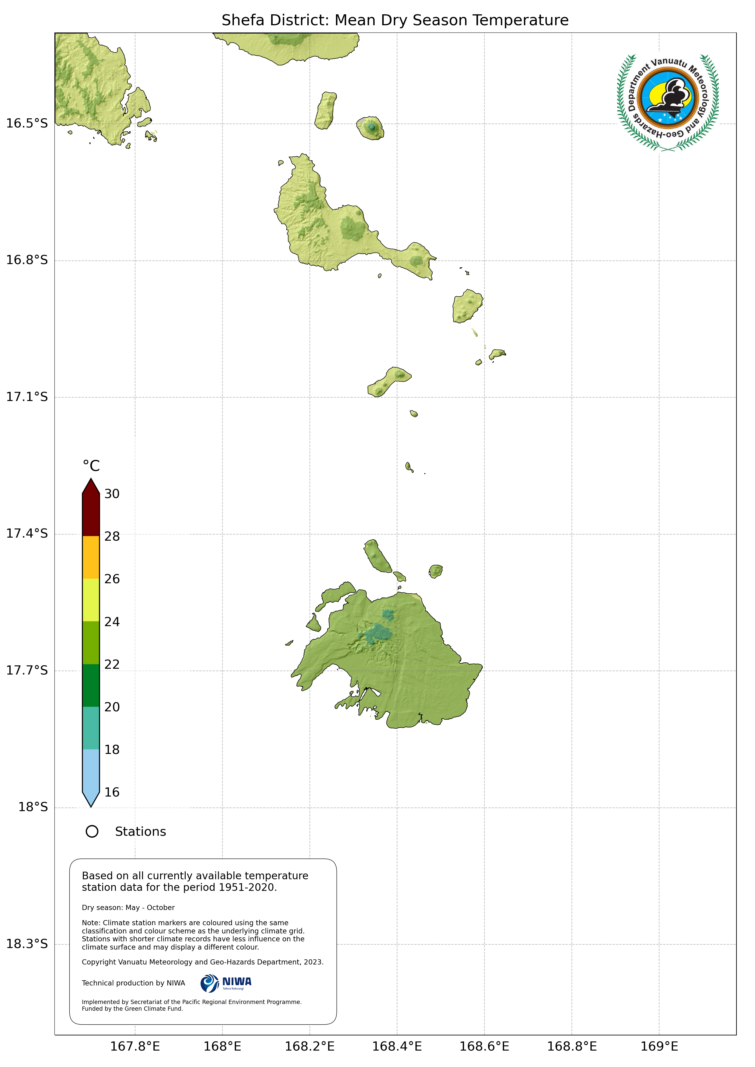
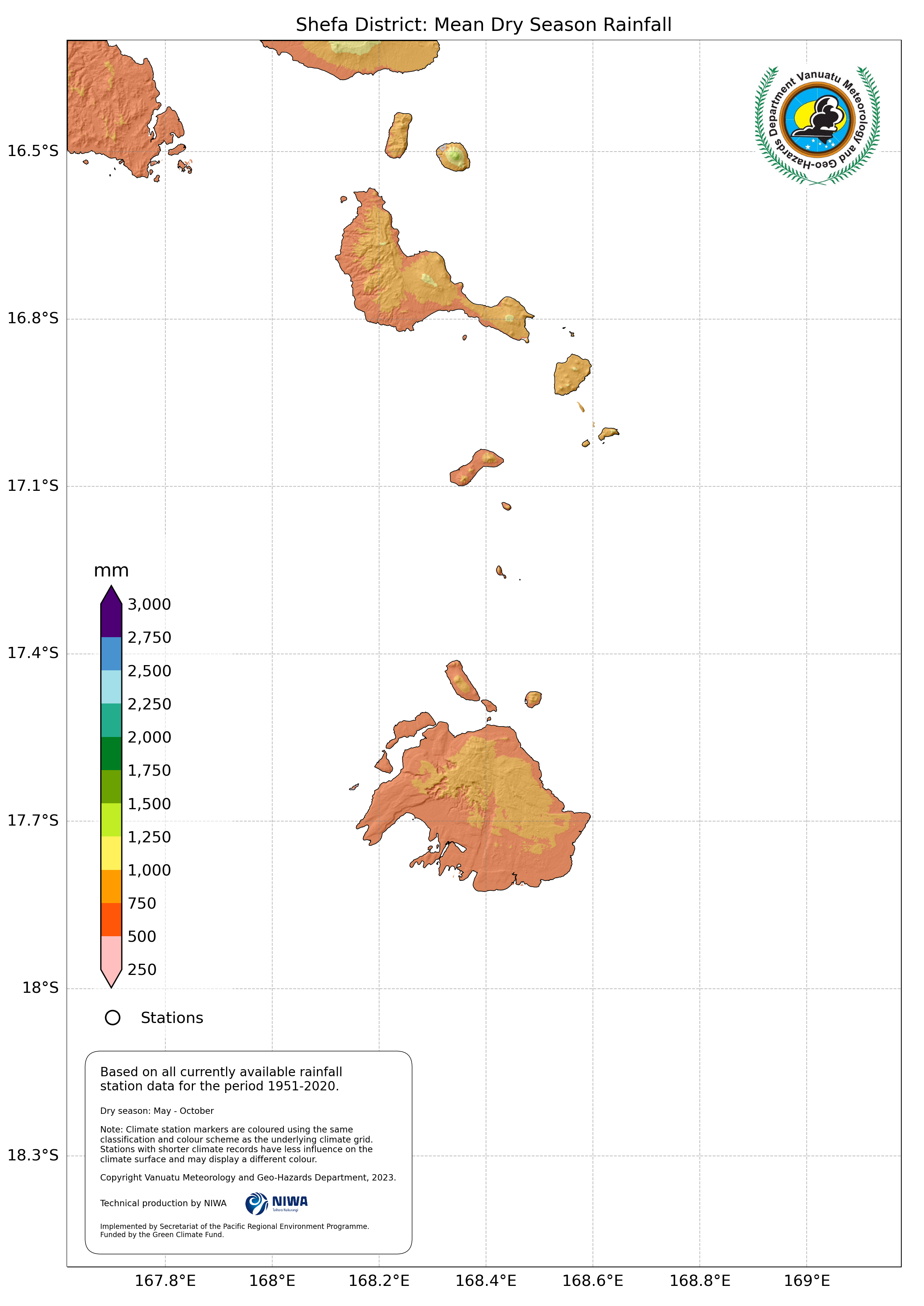
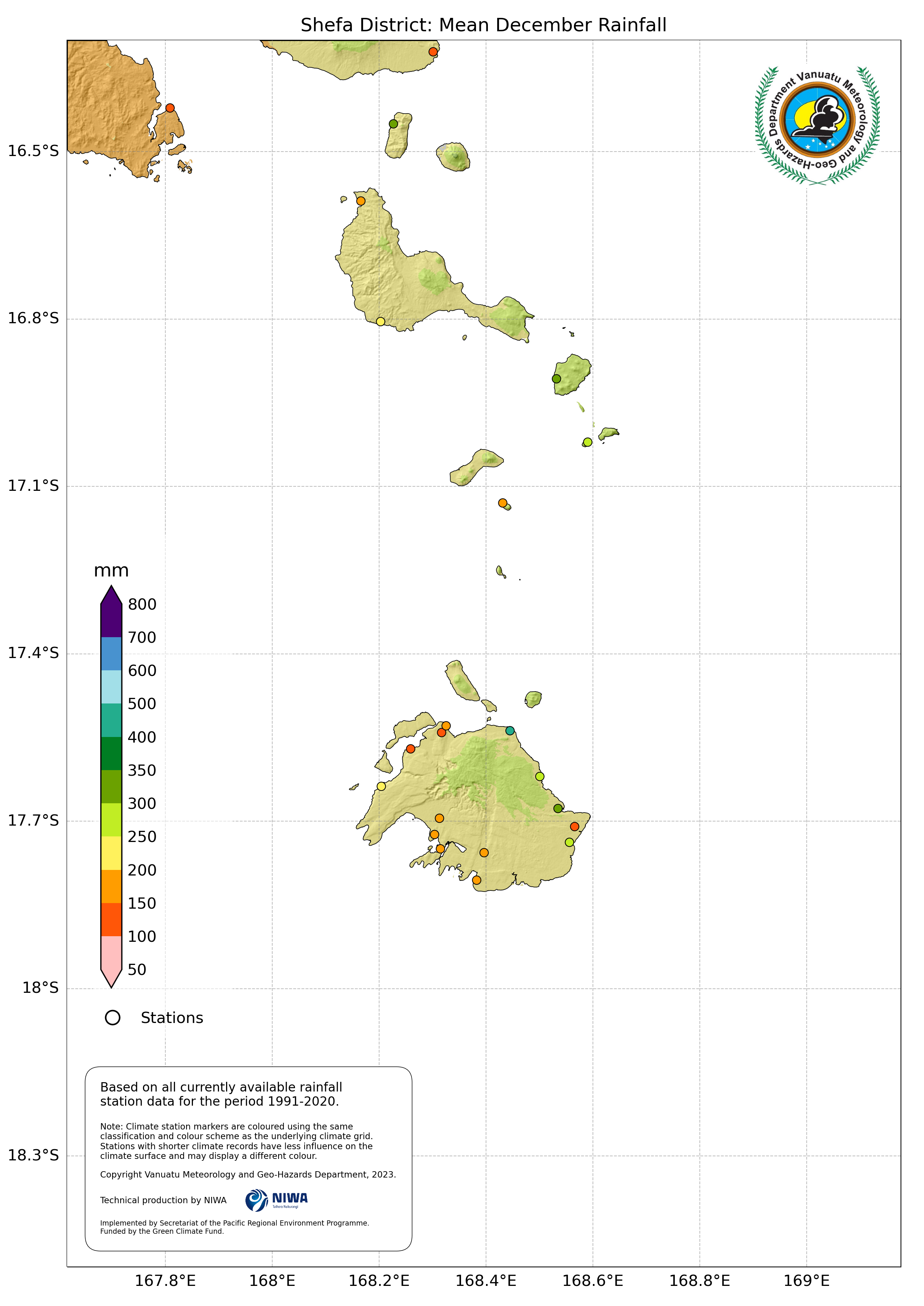
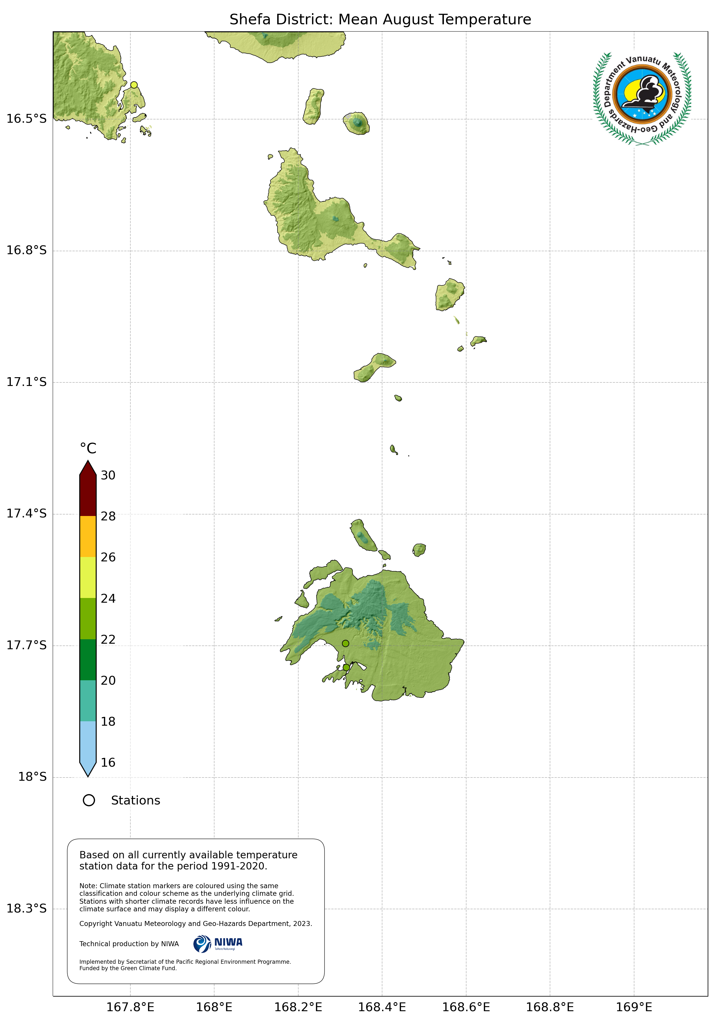
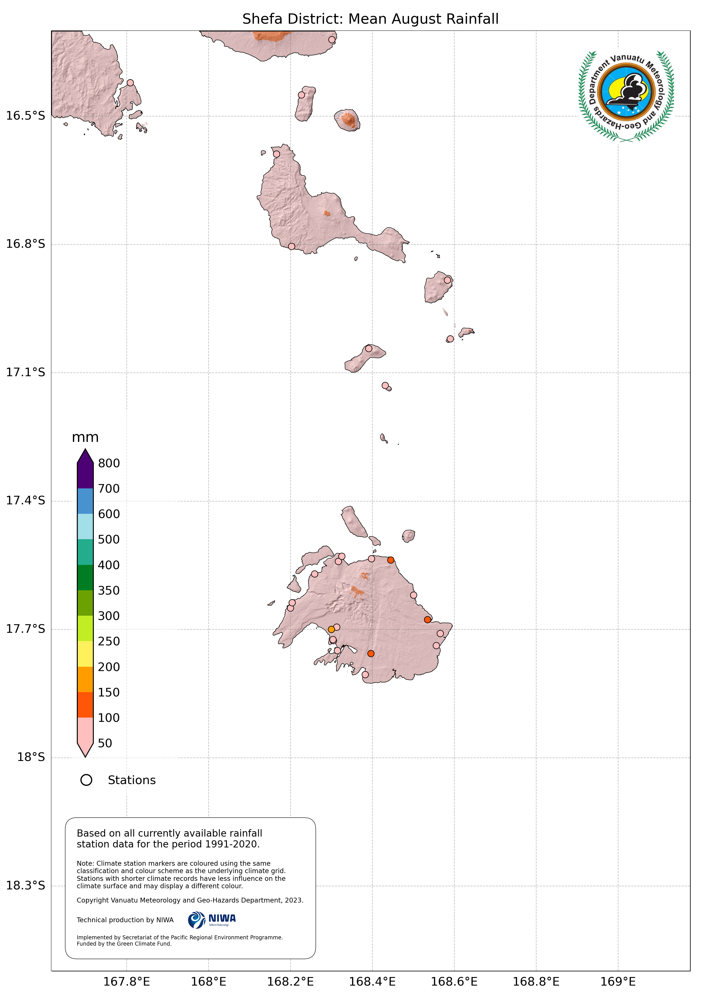
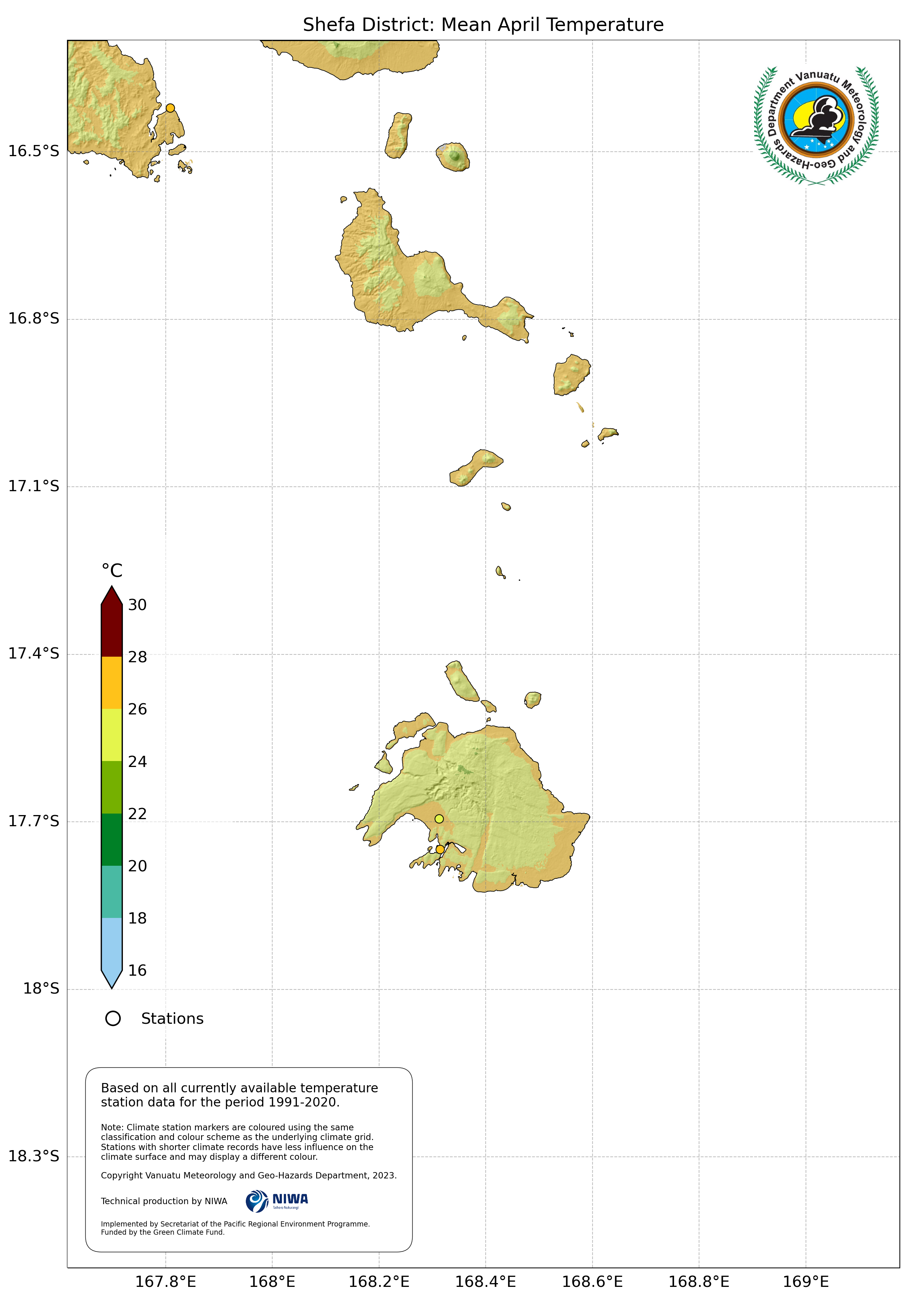
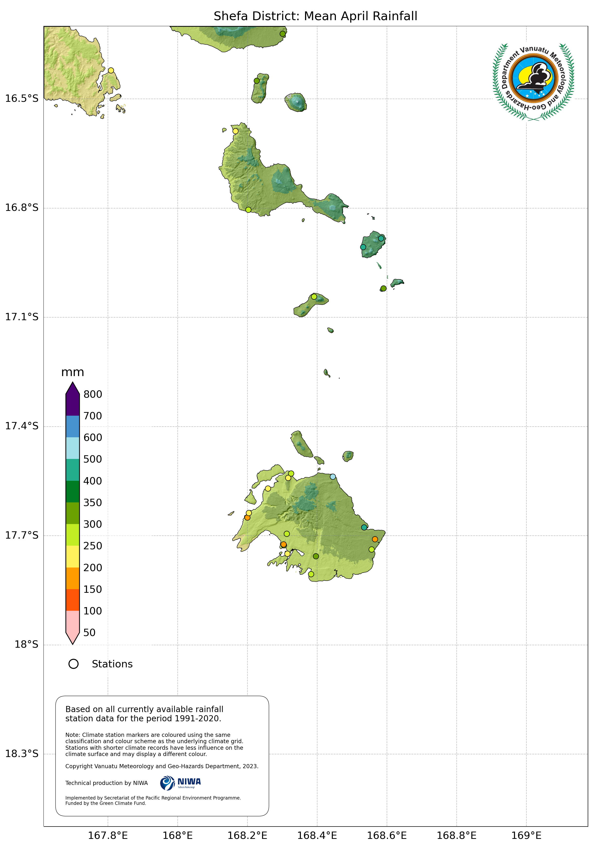
The rainfall and temperature maps are to increase understanding of climate patterns at the national and provincial levels and to ensure adaptation planning (NAPs) and policy implementation is informed by climate information (data/science) and build climate resilience in Vanuatu.
Data and Resource
| Field | Value |
|---|---|
| Publisher | Secretariat of the Pacific Regional Environment Programme (SPREP), Vanuatu Meteorology and Geo-hazards Department, NIWA |
| Modified | |
| Release Date | |
| Identifier | e1a98720-0496-4e0e-8257-baae5aa45ff4 |
| Spatial / Geographical Coverage Location | Vanuatu |
| Relevant Countries | Vanuatu |
| License |
SPREP Public Licence
![[Open Data]](https://assets.okfn.org/images/ok_buttons/od_80x15_blue.png)
|
| Author | Tavita Su'a |
| Contact Name | Sunny Seuseu |
| Contact Email | [email protected] |