This report presents, for the first time,…
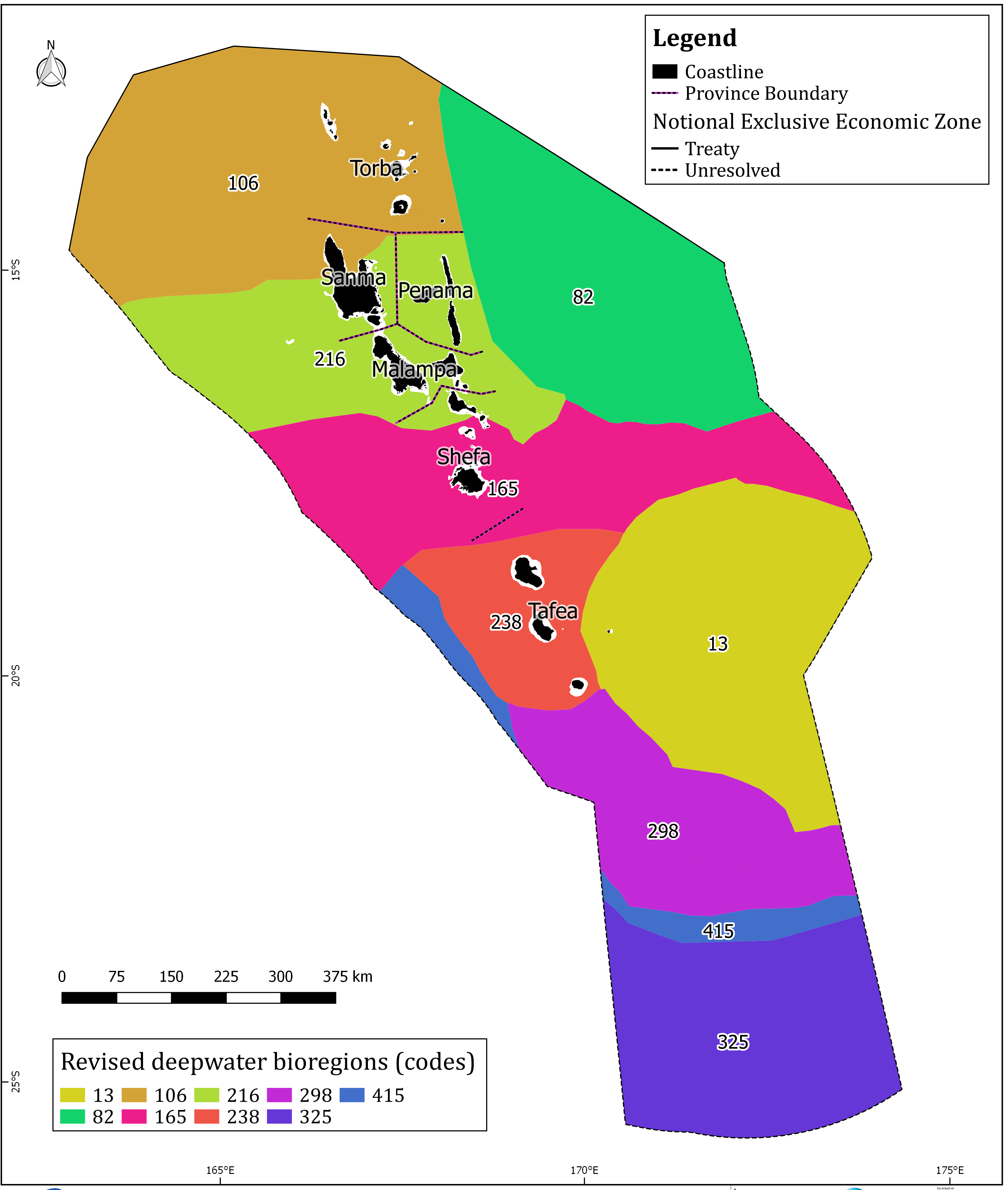
There are not perfect data which describe the distribution and abundance of every marine habitat and species in the Pacific. And certainly not at a scale that is useful for national planning in the ocean. Bioregionalisation, or the classification of the marine environment into spatial units that host similar biota, can serve to provide spatially explicit surrogates of biodiversity for marine conservation and management. Existing marine bioregionalisations however, are at a scale that is too broad for national governments in the Pacific to use. Often whole countries are encompassed in just one or two bioregions (or ecoregions).
This dataset, under the MACBIO project holds a report, and maps that present for the first time, marine bioregions across the Southwest Pacific in general, and Vanuatu in particular, at a scale that can be used nationally, as a basis for the systematic identification of an ecologically representative system of marine protected areas.
Data and Resource
| Field | Value |
|---|---|
| Publisher | Vanuatu Department of Environmental Protection and Conservation |
| Modified | |
| Release Date | |
| Identifier | 593655a3-c7bb-4cc2-b236-0867901273e9 |
| Spatial / Geographical Coverage Location | Vanuatu |
| Relevant Countries | Vanuatu |
| Language | English |
| License |
SPREP Public Licence
![[Open Data]](https://assets.okfn.org/images/ok_buttons/od_80x15_blue.png)
|
| Author | Government of Vanuatu, SPREP, GIZ, IUCN |
| Contact Name | MACBIO |
| Contact Email | [email protected] |